
YMCA of the USA: Changing Lives with Location Intelligence
MapDash Helps the YMCA Change Lives
The YMCA had a challenge.
YMCA of the USA (“the Y”) knew that the communities they served were changing dramatically. They knew that the Y needed to respond to their needs with different programming and resources. And they knew that GIS and Location Intelligence were going to be a major part of the solution.
But with over 2,600 local branches run by 20,000 full-time staff and 600,000 volunteers, the Y found it increasingly difficult to communicate and coordinate strategic decision making to staff “on the ground” when it came to programming, budgeting, and resource allocation. As staff put it:
“There’s so much you can do in the GIS space, but we wanted to know: what should we do?”
And that’s where Datastory’s MapDash services came in.
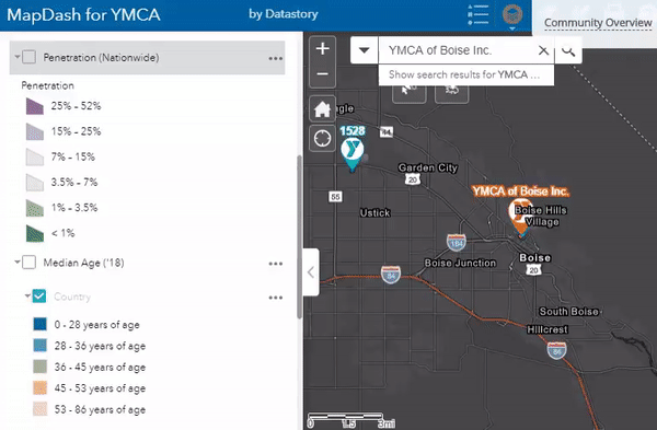
Strengthening Communities through Location Intelligence
In order to serve communities well, the team at the Y needed a way to clearly see where and how those communities were changing. They were already using some forms of GIS software and tools at a national level, but they wanted a way to get that information into the hands of their regional and local partners in a format that was easier to use, understand, and most importantly – act on.
“YMCA collects a lot of data from local branches. But the problem has always been presenting ‘what does this mean,'” said a VP on the team. “Every CEO knows the map of their community – what better way than to put the data in a map format?”
Intuitive Insights for Decision Makers
MapDash offered the Y a way to clearly, intuitively see what was happening at a local and regional level across the incredibly diverse range of communities they serve.
They noticed that many of the youth who could benefit most from the Y’s services were either too far from a YMCA branch to access them easily, or were underserved by the existing programs they offered.
MapDash provided a solution that was simple for everyone from the local to national level to understand, secure across multiple levels of organizational permissions, and deep enough to get meaningful insights about the decisions the Y may need to make.
Making an Impact Faster
The Y plans to continue sharing MapDash with their local and regional partners. It’s helped the Y streamline and align its operations in such a way that empowers stakeholders to make informed decisions faster, with more confidence, and with greater impact.
And when your organization’s mission is to provide hope to kids who need it most, those decisions matter.
“Our hope is that this can help us make an impact faster.”
What can MapDash do for your organization?
If you’re a leader in your business, chances are that right now, you’re making decisions with less information than is actually available to you. Enhancing your location intelligence with tools like MapDash can help you make better decisions about everything from site selection to marketing to recruiting.
Your data has a story to tell, and we can help you hear it. Contact us to learn more.